


Barren River Area Development District (Central)--Warren County PUMA, Kentucky
About
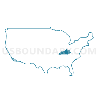
Outline
--Warren+County+PUMA%2c+Kentucky_A280.png)
Summary
| Unique Area Identifier | 192992 |
| Name | Barren River Area Development District (Central)--Warren County PUMA |
| State | Kentucky |
| Area (square miles) | 547.56 |
| Land Area (square miles) | 541.60 |
| Water Area (square miles) | 5.96 |
| % of Land Area | 98.91 |
| % of Water Area | 1.09 |
| Latitude of the Internal Point | 36.99563400 |
| Longtitude of the Internal Point | -86.42357860 |
Maps
--Warren+County+PUMA in Kentucky.png)
Graphs
Select a template below for downloading or customizing gragh for Barren River Area Development District (Central)--Warren County PUMA, Kentucky
--Warren+County+PUMA%2c+Kentucky_T0.png)
--Warren+County+PUMA%2c+Kentucky_T1.png)
--Warren+County+PUMA%2c+Kentucky_T2.png)
--Warren+County+PUMA%2c+Kentucky_T3.png)
--Warren+County+PUMA%2c+Kentucky_T4.png)
--Warren+County+PUMA%2c+Kentucky_T5.png)
--Warren+County+PUMA%2c+Kentucky_T6.png)
--Warren+County+PUMA%2c+Kentucky_T7.png)
--Warren+County+PUMA%2c+Kentucky.png)
Neighbors
Neighoring Public Use Microdata Area (by Name) Neighboring Public Use Microdata Area on the Map
Top 10 Neighboring County (by Population) Neighboring County on the Map
- Warren County, KY (113,792)
- Barren County, KY (42,173)
- Logan County, KY (26,835)
- Allen County, KY (19,956)
- Simpson County, KY (17,327)
- Butler County, KY (12,690)
- Edmonson County, KY (12,161)
Top 10 Neighboring County Subdivision (by Population) Neighboring County Subdivision on the Map
- Bowling Green CCD, Warren County, KY (81,810)
- Franklin CCD, Simpson County, KY (15,462)
- Sand Hill-Girkin CCD, Warren County, KY (8,016)
- Cave City CCD, Barren County, KY (6,707)
- Alvaton CCD, Warren County, KY (6,605)
- Brownsville CCD, Edmonson County, KY (6,288)
- Woodburn CCD, Warren County, KY (5,671)
- Smiths Grove CCD, Warren County, KY (5,625)
- Auburn CCD, Logan County, KY (5,375)
- Morgantown CCD, Butler County, KY (4,749)
Top 10 Neighboring Place (by Population) Neighboring Place on the Map
- Bowling Green city, KY (58,067)
- Plano CDP, KY (1,117)
- Smiths Grove city, KY (714)
- Plum Springs city, KY (453)
- Woodburn city, KY (355)
- Oakland city, KY (225)
Top 10 Neighboring Unified School District (by Population) Neighboring Unified School District on the Map
- Warren County School District, KY (87,088)
- Barren County School District, KY (26,750)
- Bowling Green Independent School District, KY (26,704)
- Logan County School District, KY (20,760)
- Allen County School District, KY (19,956)
- Simpson County School District, KY (17,327)
- Butler County School District, KY (12,690)
- Edmonson County School District, KY (12,161)
Top 10 Neighboring State Legislative District Lower Chamber (by Population) Neighboring State Legislative District Lower Chamber on the Map
- State House District 21, KY (52,240)
- State House District 20, KY (52,049)
- State House District 22, KY (46,341)
- State House District 19, KY (44,553)
- State House District 17, KY (42,990)
- State House District 23, KY (42,618)
- State House District 16, KY (39,295)
Top 10 Neighboring State Legislative District Upper Chamber (by Population) Neighboring State Legislative District Upper Chamber on the Map
- State Senate District 32, KY (126,482)
- State Senate District 3, KY (113,250)
- State Senate District 9, KY (112,974)
Top 10 Neighboring 111th Congressional District (by Population) Neighboring 111th Congressional District on the Map
Top 10 Neighboring Census Tract (by Population) Neighboring Census Tract on the Map
- Census Tract 117, Warren County, KY (8,016)
- Census Tract 115, Warren County, KY (6,605)
- Census Tract 9204, Edmonson County, KY (6,288)
- Census Tract 114.01, Warren County, KY (6,190)
- Census Tract 118, Warren County, KY (6,065)
- Census Tract 108.03, Warren County, KY (5,893)
- Census Tract 111, Warren County, KY (5,821)
- Census Tract 119, Warren County, KY (5,671)
- Census Tract 116, Warren County, KY (5,625)
- Census Tract 110.02, Warren County, KY (5,501)
Top 10 Neighboring 5-Digit ZIP Code Tabulation Area (by Population) Neighboring 5-Digit ZIP Code Tabulation Area on the Map
- 42101, KY (55,648)
- 42104, KY (29,610)
- 42103, KY (18,936)
- 42134, KY (16,785)
- 42164, KY (16,277)
- 42261, KY (10,602)
- 42171, KY (6,841)
- 42206, KY (5,407)
- 42122, KY (4,368)
- 42210, KY (4,236)